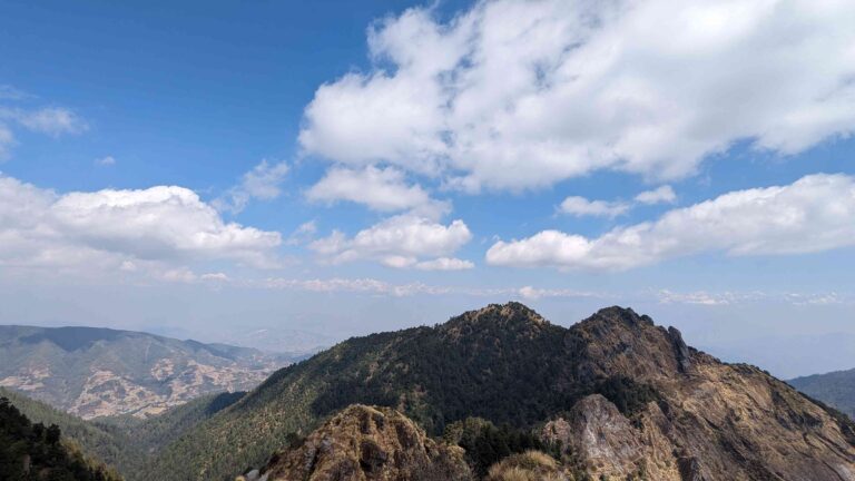
The Makalu Base Camp trek is a challenging, off-the-beaten-path trek that takes in some of Nepal’s best features, including tranquil routes, colorful terraced agriculture, rural cultures, rhododendron woods, uncommon wildlife, and multiple peaks up to 8,000 meters or higher.
Makalu Barun National Park in Nepal is a part of the enormous Samargatha National Park and is located in the Sankhuwasabha and Solukhumbu districts. About 590 square miles make up its surface. The path to the base camp of the fifth-highest mountain in the world leads you through the untamed wilderness of Makalu Barun National Park, which is renowned for its exceptional natural beauty and wide variety of flora and wildlife. As you climb from 700 meters to over 5,000 meters, the view offers a wonderful variety and contrast.
The trek is difficult yet incredibly rewarding. A wonderfully beautiful day of trekking involves traversing four high passes, including the Shipton La (Eric Shipton’s original expedition route), three of which are over 4,000 meters. Additionally, crossing the passes is more thrilling if you make this excursion in the spring when there may still be snow on the ground.
Details of Makalu Base Camp
| Name of the Trek | Makalu Base Camp Trek |
| Trekking Region | Makalu, Everest, East Nepal |
| Trekking Difficulty | Strenuous |
| Number of Days | 16-18 days |
| Maximum Elevation | 4900 m |
| Accommodation | Homestay, tea houses and camping |
| Major Attractions | Remoteness, Distinct culture and breathtaking views of Eastern Nepal |
Highlights of Makalu Base Camp Trek
- Experience the stunning ascent to the foot of Makalu, the fifth-highest mountain in the world (8481m).
- Cross three further passes above 4000 meters in elevation in addition to the famous Shipton La pass in a single day.
- Explore one of the world’s most isolated and unexplored trekking routes.
- As you climb from 700 meters from the beginning to over 5000 meters, discover the rich flora and fauna and diverse vistas of geographical diversity.
- Enjoy the welcoming hospitality and way of life of the Sherpa, Rai, and Limbu communities in the isolated villages.
Detailed Itinerary of of Makalu Base Camp Trek
Day 1: Flight from Kathmandu to Tumlingtar, Drive to Num (1980 m)
Our flight to Tumlingtar lasts one hour in the morning. Once there, we continue north into Khandbari, a significant town in the district where the government authorities are located. The journey to Khandbari takes around 30 minutes on a winding, hilly route. Following this, you drop to Chichila at 1,900m, a little settlement with a police checkpoint where you must show your trekking permit, before continuing on a twisting dirt road to the highest point at 1,960m. Views of the hills covered in trees in the area are beautiful. It gets a little bumpier from here till Num since the road starts to deteriorate from Chichila.
Day 2: Trek from Num to Seduwa (1560 m)
You lose and gain height in one day today with a significant, steep descent to the Arun River that takes around two hours to complete and a significant ascent to Seduwa. We cross the Arun River (660 m). We stroll across the corn and buckwheat field after ascending a steep hill from the bridge to a tea establishment. And, we make a long, steep, difficult climb to Seduwa as we proceed up the rocky slope and through the tiny terraced fields of corn and barley. Seduwa has a few tea establishments, small stores, and residences.
Day 3: Trek from Seduwa to Tashigaon (2100 m)
Our route from Khola to Gyang is along the River Rasuwa (1770m). The trail leads to Hindrungma village and then on to Rupisa from here, passing through forested areas and terraced fields. Comparing today’s walk to yesterday’s, it is fairly pleasant. We begin walking the six hours from Seduwa village to TashiGaon after lunch. Finally, you make your way down to a log bridge before making your final ascent of stone steps to Tashigaon. You must hike a bit through the village because the lodges are all perched on the top.
Day 4: Trek from Tashigaon to Khongma Danda (3637 m)
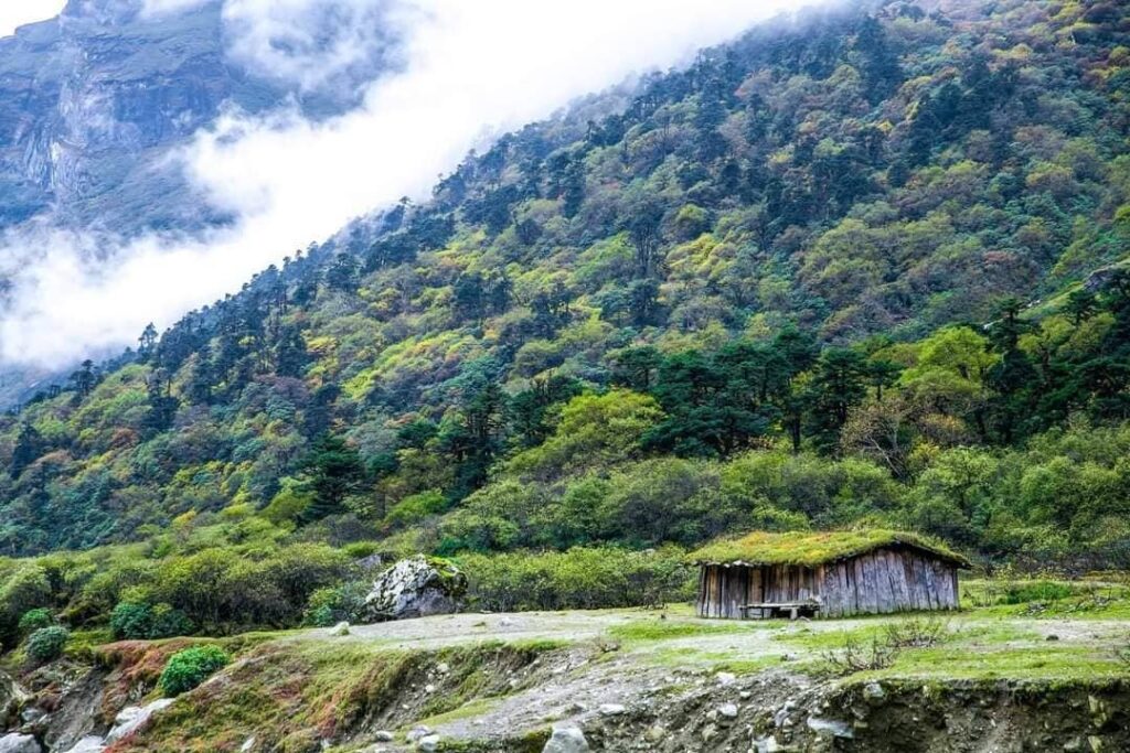
We have much climbing to do today. We arrive at Dhara at 2,867m after traveling for almost three hours. It has a tea shop, so you might eat lunch there because it’s your only opportunity to stop for refreshments until reaching Khongma. After leaving Dhara, the ascent to Unshisa, which is located at 3,200 meters, requires a strenuous climb of about an hour. Through a rhododendron forest, the climb from Unshisa is even more difficult and uphill. After several hours of straining upward from Unshisa, you arrive at a stone rest area with prayer flags, which leads you to Khongma Danda.
Day 5: Acclimatisation Day at Khongma Danda
Acclimatization is essential for treks that entail high altitudes. Furthermore, it’s crucial that we become used to the weather and altitude because we have to cross four passes the next day. Today, we strongly urge you to climb up to the Khongma La through rhododendron trees all the way to the pass at 3,890 meters. In approximately an hour, you ought to arrive at the pass. Then, fit and accustomed to your surroundings, you return to Khongma.
Day 6: Trek from Khongma Danda to Dobate (3860 m) through Khongma La, Sano Pokhari Danda, Shipton La and Keke La
Today’s walk is the main highlight of this trek, with nearly continual breathtaking vistas of snow-capped peaks as we cross four high passes. It’s possible that you won’t have lunch until you get to Dobate, so pack plenty of snacks and drink because it’s going to be a long, arduous day. The Khongma La, which is 3,890 meters above sea level, is reached after about an hour of climbing through rhododendron bushes.
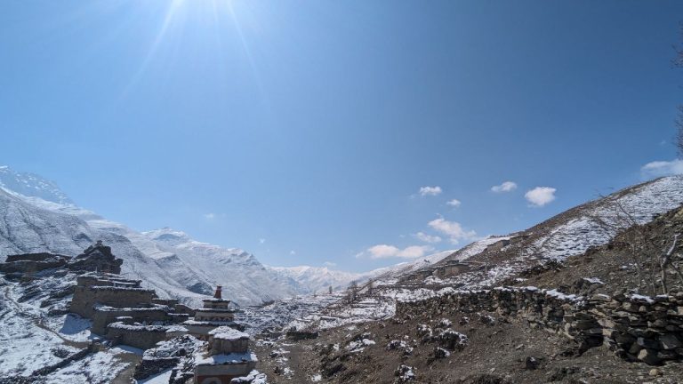
You make a brief descent before making a climb in the direction of your second pass. As you cross an open slope, you can see Kanchenjunga in the distance. Sano Pokhari Danda at 4,105 meters, with Sano Pokhari Lake below, is reached after some difficult stone stairs. The Shipton La, which is 4,200 meters above sea level, is reached after a few hours. A mani wall and cairn close to the shelter serve as markers for the pass. They are both decorated with prayer flags.
You descend on less steep terrain to reach 4,080-meter Kalo Pokhari Lake. From the lake, the ascent to the Keke La, which is at 4,170 meters, is simpler. After around another 45 minutes of descent, you arrive at your lodging in Dobate, which is a very nice sight after your four pass labors.
Day 7: Trek from Dobate to Yangle Kharka (3630 m)
This morning’s descent through forests of pine and rhododendrons is truly pleasant. Through the trees, there is a sharp decline that leads to the Barun River. Once there, you start your walk toward the river.
A tea shop is located at Themathang Kharka, 3,500m, after a quick hike. To get here from Dobate, it takes roughly four hours. Just prior to reaching Themathang, there is a magnificent waterfall. In order to cross the Baron Khola on a wooden bridge, you must first walk for a short distance from here. Reaching the meadows of Yangle Kharka and your overnight lodging takes around 112 hours from the tea store in Themathang. The location is wild, isolated, and windy.
Day 8: Trek from Yangle Kharka to Langmale (4420 m)
With the river on your left and the alluring aroma of juniper accompanying you as you walk, it’s a lovely and relatively flat start. The trail widens as you pass Jhak Kharka, Yak Kharka, and eventually Merek, where a welcoming tea shop can be found after around two and a half hours of trekking. As you labor upwards toward Langmale, you will undoubtedly feel the altitude, so go slowly and steadily. Your tea house in Langmale is about a two-hour drive from Merek. Peak 7 serves as a breathtaking background to the lodge rooms, adding to the location’s spectacular vistas.
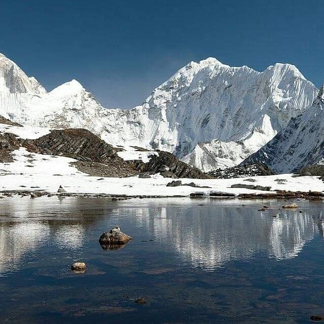
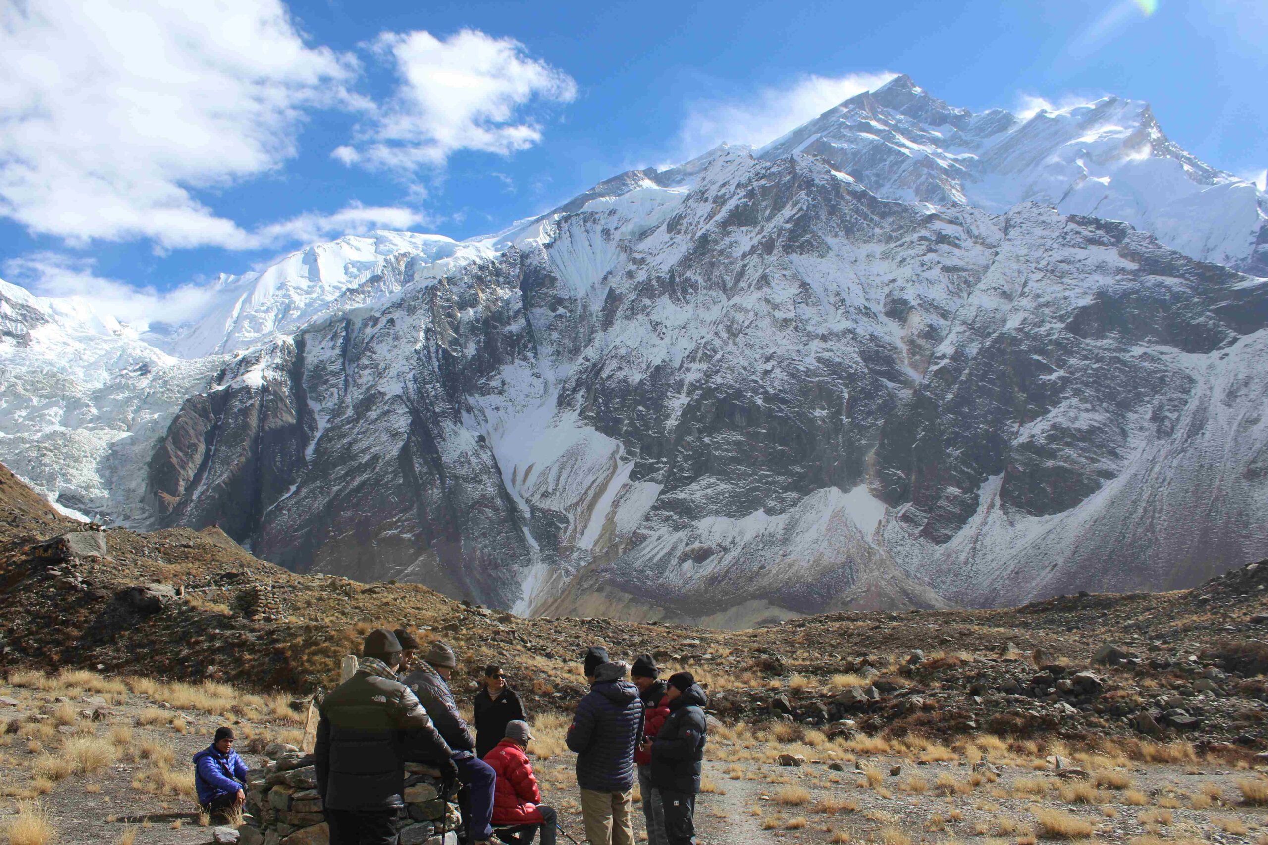
Day 9: Trek from Langmale to Makalu Base Camp (4900 m)
We get to Makalu Base Camp today. At 4900 meters, Makalu Base Camp is the highest base camp on Earth. A broad, level region with a locked tiny stone house, known as Shershong, at 4,630m, is reached after a few hours of walking and is a suitable camping location. A little pass, 100 meters above Makalu Base Camp, is where we arrive after descending. The vista is entirely dominated by Makalu, the fifth-highest mountain in the world, as one might imagine. The base camp may be home to a large number of Tibetan snowcocks, hill pigeons, black redstarts, and mountain finches.
Day 10: Exploration day at Makalu Base Camp
We get a great view of Everest and Lhotse as well as the spectacular south face of Makalu from this location. In a similar way, we can tour the region’s lakes and glaciers, take pictures, and enjoy the time that remains.
Day 11: Trek back from Makalu Base Camp to Yangle Kharka
You leave Mount Makalu’s magnificent spectacle behind and start walking back to Yangle Kharka. It takes around two hours to get to the Shershong meadow. Shershong is identified by a hut covered in a visibly orange tarp. You return to Langmale after another hour or so, where you can have tea and possibly lunch. You arrive next to the tea store in Merek after approximately an hour of downhill walking. Before navigating your way back to Yangle Kharka through pine forests, it is wise to relax here with a cup of tea.
Day 12: Trek back to Dobate
It will take you about 1.5 hours to return to Themanthang. You will eventually need to traverse the landslide region, which will take you about 1.5 hours. As you near the lodge at Dobate, the ascent gradually eases and the walking gets easier. Make sure you pack plenty of snacks. After the tea store at Themathang, which is near the beginning of your walk, there are no more rest places until you reach Dobate.
Day 13: Trek back to Khongma
It should take about 1.5 hours to climb to the Keke La at 4,170 meters from the starting point . Reaching Shipton La, which is 4,200 meters above sea level, will take you another hour. The big cairn that marks Sano Pokhari Danda at 4,105m is another hour or two of contouring along the mountainside. Back at the final pass, the 3,890m-high Khongma La, distinct by a mani wall, takes another hour. You return to your lodging in Khongma after an about 250 m descent, primarily on stone steps.
Day 14: Trek back to Tashigaon
It takes about two hours to descend from Khongma to Dhara Kharka. You’ll undoubtedly pause here for a cup of tea. The final 3 hours are spent on the descent to Tashigaon.
Day 15: Trek back to Seduwa to Num
It would take you around 4-5 hours to go back the way you came to Seduwa today. The majority of the stone stairs used in the long, rather steep descent to the 770m-deep Arun River are made of stone. As you descend deeper into the jungle, it will feel incredibly warm. You cross the river and make the 800-meter ascent to return to Num.
Day 16: Drive to Tumlingtar, Fly back to Kathmandu
In order to catch the return trip to the airport in Kathmandu, you return back to Tumlingtar.
Best Time to Visit Makalu Base Camp
The spring season, which brings pleasant weather and rhododendrons in full bloom, makes March through May an ideal time to travel to Nepal. The optimum seasons to visit Makalu Barun National Park are, therefore, Spring and Autumn. The harsh winters make camping nearly impossible. Also, the monsoon rains that fall between June and September at Makalu Barun National Park cause landslides and obstruct mountain views.
Difficulty of Makalu Base Camp Trek
It’s recommended that experienced mountain trekkers undertake this difficult trip. The lodges in this region are of a lower caliber than some other regions. So the comfort levels are more basic than on certain well-known Nepal treks. This journey is not particularly difficult, though, as a few days for relaxation and acclimatization are included in the schedule.
[…] up to this ridge for roughly 7 to 11 days. This trek offers views of majestic mountains including Mt. Makalu, 8,463 m to the west, and Mt. Kanchenjunga, 8,586 m, located in Nepal’s eastern […]