
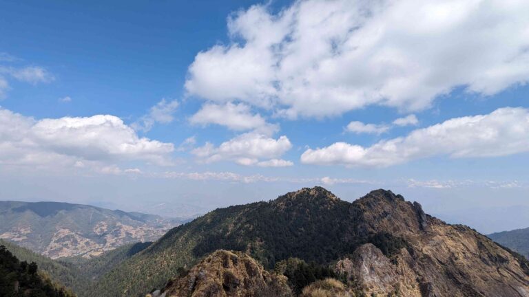
The third-highest mountain in the world, Kanchenjunga (8,586 m), is located in the Kanchenjunga Conservation Area. The Kanchenjunga Conservation Area is home to natural forests, alpine meadows, and high altitude wetlands alongside these beautiful and spectacular Himalayan peaks. With its highest peak being in Nepal, the Kanchenjunga mountain range spans parts of both India and Nepal. The Kanchenjunga Base Camp Trek is a off-beaten trek in Nepal that takes you past lonely Tibetan villages higher up in the semi-arid plateaus at the foot of the mountain, as well as lush, green, semi-tropical Rai and Limbu villages in the mid-hills.
The WWF and local communities work together to manage this remote, breathtakingly beautiful, and ecologically diversified conservation region. The region houses endangered and reclusive snow leopard and red panda as well as the vulnerable Himalayan black bear, clouded leopard.
Details of Kanchenjunga Base Camp Trek
| Name of the Trek | Kanchenjunga Base Camp Trek |
| Trekking Region | Kanchenjunga region, Eastern Nepal, Sikkim-India, |
| Trekking Difficulty | Strenuous |
| Number of Days | 20-22 days |
| Maximum Elevation | 5143 m Pangpema |
| Accommodation | Homestay, tea houses and camping |
| Major Attractions | Remoteness, Distinct culture and breathtaking views of Eastern Nepal |
Highlights of Kanchenjunga Base Camp Trek
- Amazing vistas of Kanchenjunga, Jannu, and other nearby Himalayan giants as well as far-off glimpses of the eastern slopes of Makalu and Everest.
- To reach the source of the Tamur and Ghunsa Rivers, which is located on the northwest side of the Kanchenjunga Himal, follow the glacial torrent. It’s stunning to pass by the glacier lakes along the journey.
Also See: Makalu Base Camp Trek – YTROT
Detailed Itinerary of Kanchenjunga Base Camp Trek
Day 1: Flight from Kathmandu to Bhadrapur, Drive to Ilam (1677 m)
We take a scenic flight to Bhadrapur from Kathmandu on the first day of our trek. Upon landing, we enjoy the breathtaking countryside as we take a jeep to Ilam. Charming Ilam is known for its cheese-based Himalayan chew and is home to big tea plantations.
Day 2: Drive from Ilam to Chiruwa, Taplejung (1820 m)
After breakfast, we take a four-hour drive over hills and terraced farms to Taplejung, where we spend the night. Chiruwa is situated in a gorge in the Himalayas with cliffs and substantial subtropical rainforest sections. The Kirati ethnic group, currently called Limbu, has roots in this area dating back more than 2000 years as a subsistence farmer. The place has abundant of Buddhist gompas.
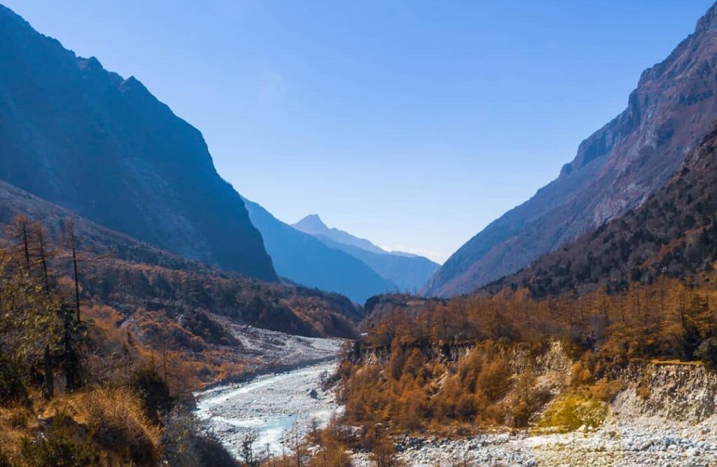
Day 3: Trek from Chiruwa to Sukethum (1640 m) 6-7 hours
We start our walk today to Sukethum. The trek is enjoyable and fulfilling because of the clearly marked trail. There are only a few more ascents until we reach the valley and start to pick up on subtle changes to the scenery. We go by the settlement of Tapethok and cross a branch of the Tamur River as we make our way through forward. Then we along what is now known as the Gunsa Khola, over multiple bridges.
Day 4: Trek from Sukethum to Amjilosa (2390 m) 6 hours
We follow the Ghunsa River along the extremely narrow trail till our lunch break. The trail presently features waterfalls and suspension bridges. After lunch, there is a difficult ascent to our overnight camp at Amjilosa. There are not many families who permanently reside in Amjilosa. Amjilosa is a small Tibetan village that is primarily used when the yaks and sheep are in the pastures.
Day 5: Trek from Amjilosa to Gyabla (2730 m) 6 hours
The majority of our trek today will take us through a forest, and we’ll see lots of waterfalls along the route. As we go through the peaceful forest settings, we have a sense of isolation because there are no villages to pass through. Along with a wide diversity of birds, the trail also has yaks, sheep, and goats. The track leads us to Gyabla, where we spend the night, after lunch, through a forested area and a wooden bridge.
Day 6: Trek from Gyabla to Ghunsa (3430 m) 6 hours
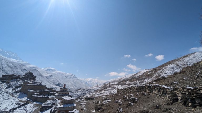
The trail from Gyabla goes through a village, across a large meadow, climbs a modest slope, and then descends to bridge the river into Ghunsa. Our lunch location is in Phole village, which is a typical Tibetan village and the villagers of Ghunsa’s winter settlement. We walk a small trail through dense forests to get there. The last and largest village in the valley is Ghunsa. The major sources of income for the residents of this village are yak farming and carpet making. All trekkers traveling to and from KBC and the Sale La Pass intersect in Ghunsa.
Day 7: Acclimatisation Day at Ghunsa Village
While taking walks at a higher altitude, acclimatization is required. We take a stroll today around Ghunsa and the closest viewpoint to acclimate our bodies to the altitude and the climate. We walk for three hours to the River Khanso Thanso, from which point we can see Mt. Khumbakaran, Phole Peak, and Sobithongi Peak in the distance. You can unwind and explore the vibrant Tibetan village of Ghunsa for the remainder of the day.
Day 8: Trek from Ghunsa to Khangpachen or Khambachen (4040m) 7hrs
The trail ascends gradually from Ghunsa along the south bank of the Ghunsa river, passing various mani walls and chortens. We will be passing through lovely pine and rhododendron forests. Before we descend to Khambachen, our overnight accommodation, we must traverse a number of scree slopes and some glacial moraine. A dozen or so houses make up the Tibetan community of Khambachen, which is located in a grassy plain. Khangpachen also called Khambachen is surrounded by mountains with a stunning view of the enormous north face of Jannu.
Day 9: Trek from Khambachen to Lhonak (4780m) 6 hrs
We leave Khangpachen behind and proceed along the path that runs alongside Kanchenjunga Glacier on the left. In order to get to the Lhonak campsite, we travel across a lofty plateau. Massive mountain summits including Wegde Peak (6802m), Mera Peak (6364m), Nepal Peak (7177m), Twins (7350m), and many others can be seen in the distance from Lhonak. We can set up tents among the huge stones to avoid the wind.
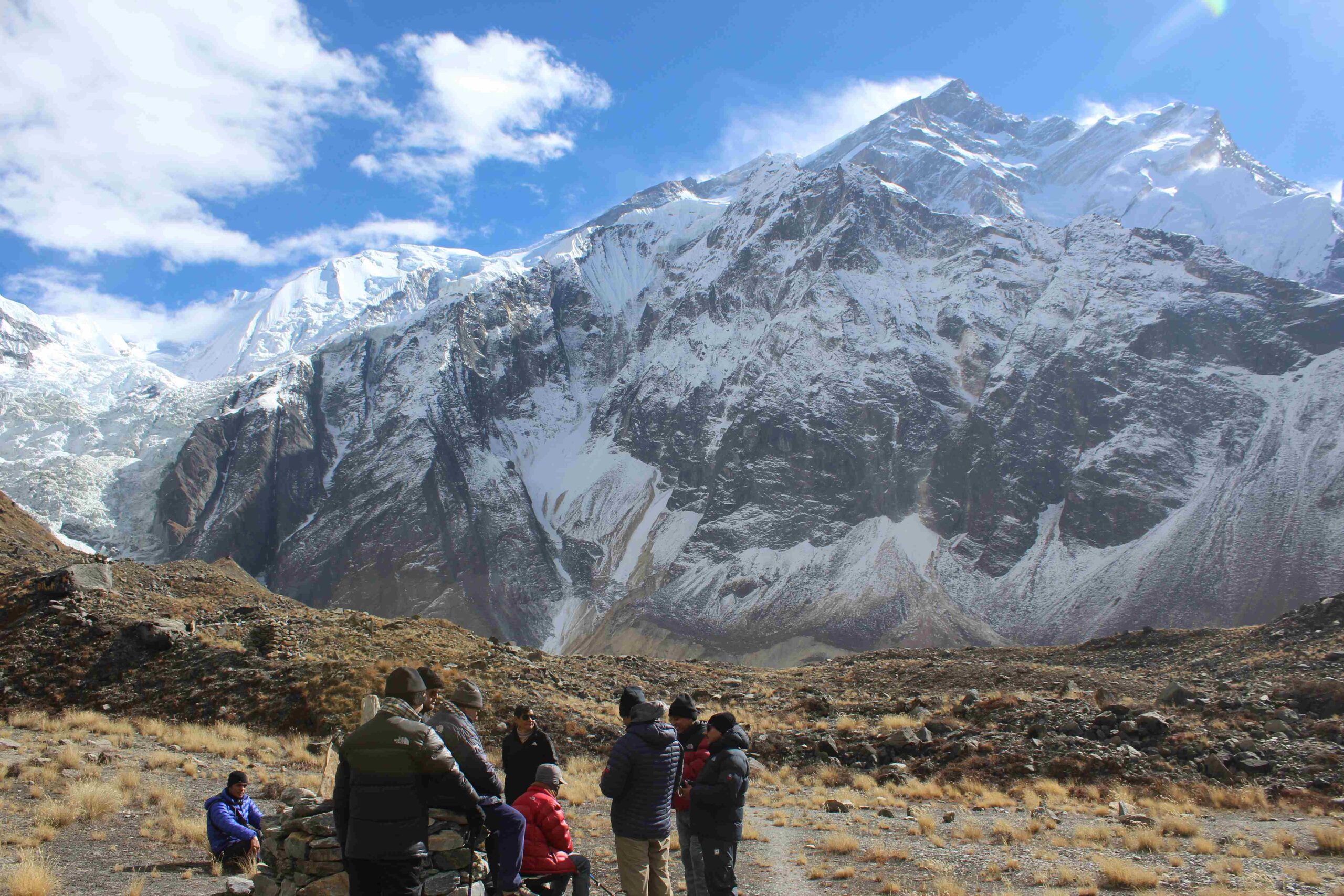
Day 10: Trek from Lhonak to Kanchenjunga Base Camp (5143m)
Today, we travel the trail that runs beside the glaciers on the northern peaks in the direction of Kanchenjunga Base Camp. The Kanchenjunga Base camp, also known as Pang Pema, offers a breathtaking view of Mt. Kanchenjunga (8586m), as well as the skyline of snow-capped mountain ranges that border Nepal with India and Nepal with Tibet.
Day 11: Trek back to Khambachen
We return to Khangpachen using the same route. The descent is much speedier but tough on the kneecaps.
Day 12: Trek back to Ghunsa
We return to Ghunsa overnight after retracing our tracks.
Day 13: Trek from Ghunsa to Sele le Pass (4500 m)
The ascent begins from Ghunsa and follows the shepherds’ trail. Our ascent today takes us through a dense birch, pine, and rhododendron woodland.
Day 14: Trek from Sele Le to Tseram via Sinion La Pass (4660 m)
For the first two hours, there is a steady ascent to Sinion La Pass, which offers the best views of Khumbakaran (Jannu Himal). The last portion of the day’s walking involves ridges, with a final descent to Tseram. We can see Kanchenjunga, Kabru, and the Himalayan range before descending. We set up camp for the night in a wide flat meadow.
Day 15: Trek from Tseram to Ramche and Kanchenjunga South Base Camp (4580 m)
We move towards Ramche by passing the moraines of Yalung Glacier and entering an ablation valley. Along the Yalung Glacier’s moraine, the trail ascends into a valley. After stopping for lunch at Ramche, we continue walking for around 40 minutes to get to Kanchenjunga South Base Camp. The Base Camp is flanked by Tibetan prayer flags and is located right on the brink of the glacier. We go back the way we came after staying the night in Tseram.
Day 16: Trek from Tseram to Tortong (2995 m)
We travel through the heavily forested trail lined with bushes and rhododendrons as we head toward Tortong. On our approach to Tortong, we also come across a few streams, Chortens, monasteries, ponds, and waterfalls.
Day 17: Trek from Tortong to Yamphuding (2080 m)
We continue to descend to the Amji Khola and then descend to Yamphudim after passing over Lasiya Bhanjyang (3310m) and Dhupi Bhanjyang (2620m). Sherpa, Rai, Limbu, and Gurung people live in the village of Yamphudim. In Yamphudim, spend the night at a lodge.
Day 18: Trek from Yamphuding to Khebang (1915 m)
We leave Yamphudim behind as we make our way downhill to Khebang, going through forests, valleys, and waterfalls. To get to Khebang, we walk past a few small towns along Kabeli Khola and over suspension bridges over a few streams. Spend the night in a homestay or guesthouse in Khebang.
Day 19: Drive from Khebang to Ilam (1677 m)
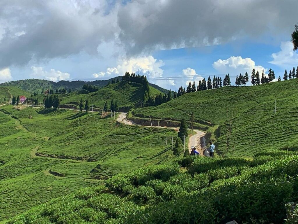
Driving to Ilam through Taplejung will take most of today. Driving to Ilam through Taplejung will take most of today. East of Nepal’s capital, Ilam, is a stunning highland station. It is highly known for producing tea and has terraced tea gardens, lush green forests, holy sites, and a distinctive culture.
Day 20: Drive to Bhadrapur, Fly back to Kathmandu
We will drive to Bhadrapur after breakfast to catch our flight back to Kathmandu.
[…] Also see: Kanchenjunga Base Camp Trek – YTROT […]