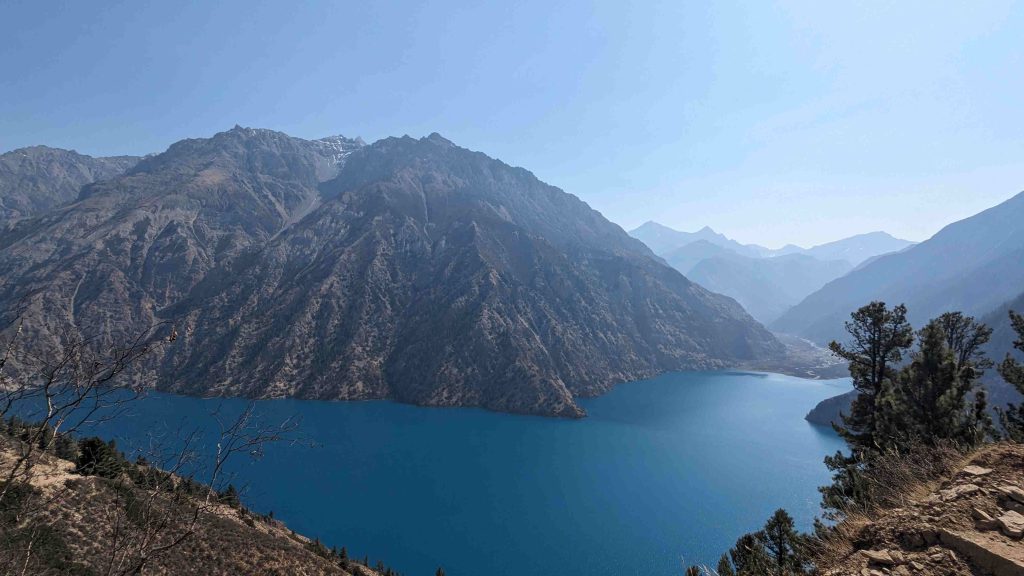
Upper Dolpo Trek had been on my bucket list for the longest time. My first solo trek was to Phoksundo Lake in Dolpo, and it was there that I learned from locals and seasoned trekkers that Upper Dolpo is an unparalleled experience. As enchanting as Shey Phoksundo is, locals describe it as merely the gateway to the true wonders of Dolpo. Since then, I had a persistent desire to venture on the Upper Dolpo Trek.
The seed of my Dolpo adventure was first planted when I watched the movie “Caravan (Himalaya)” as a child. The film’s portrayal of Dolpo’s majestic landscapes captivated me, and I vowed to visit Dolpo one day. My trek to Phoksundo Lake fulfilled part of this promise, but Upper Dolpo still beckoned.
Early Planning for Upper Dolpo Trek
Three years passed as I explored other trekking routes, unable to return to Dolpo. In the spring of 2024, a close friend introduced me to an acquaintance, Kailash dai, who wanted to undertake the Upper Dolpo Trek and document the journey. My friend, aware of my long-standing desire to explore Upper Dolpo, suggested we meet.
We met early one morning at Bouddha, both being early risers, which set the tone for our developing friendship. We met several times afterward, trying to gel our vibes together and evaluate if we could traverse this challenging journey as a team. Both Kailash dai and I were keenly observing each other’s personalities, understanding the importance of compatibility, especially for a trek of this magnitude. Traveling together on such a demanding trek requires a strong bond and mutual trust. We needed to depend on each other as we ventured into one of the most remote parts of the country, encompassing three high passes. Each meeting helped us strengthen our camaraderie and belief in each other, building the foundation necessary for our upcoming adventure.
Having previously set foot in Dolpo, I took on the responsibility of finalizing the itinerary and dates for our Upper Dolpo Three Passes Trek. With excitement and anticipation, we began preparing for what promised to be an unforgettable journey.
The Beginnng of My Upper Dolpo Trek
Day 1 – The Journey Begins: To Radi Jiula
It was set that we would start our journey on April 21, 2024, beginning from Bhairahawa. We planned to start super early since Kailash dai, who would be driving, preferred to start early and rest early. So, we set off from Bhairahawa towards Surkhet, with fairly light traffic on the highway. In about four hours, we reached Kohalpur. From the Kohalpur roundabout, we took the right towards Surkhet along the Birendra Highway. The road was smooth but slightly narrow. Leaving the Terai plains, we drove into the hilly regions of West Nepal.
Another two hours of driving brought us to Dhunche. Dhunche separates the way for two major tourist attractions in the Karnali region: one route goes towards Kalikot, eventually leading to Jumla and Rara, while the other heads towards Jajarkot, Rukum, and Dolpa. We took the latter. After having lunch at Dhunche, we rested briefly before resuming our drive towards Jajarkot.
Crossing Districts, Reaching Radi
In Nepal, district borders are often marked by rivers. On our journey to Dolpa, we crossed several districts: Surkhet, Salyan, back to Surkhet, and then West Rukum. Our destination for the day was Radi Jiula, a village in West Rukum bordering Dolpa. The drive along the serene waters of the Bheri River was beautiful, with the river never leaving our sight. We passed through Jajarkot and traversed northeast towards the more remote parts of Rukum. At dusk, we finally reached Radi Jiula, a village hampered by the latest earthquake, evident from the remnants of destroyed houses.
Radi Jiula marks almost the border between Rukum and Dolpa. We had decided to leave our vehicle there and continue our journey on foot the next day. We spent the night at a local’s house, having decided to avoid hotels and lodges as much as possible to experience the local lifestyle. The hospitality was heartwarming, and we were treated to a lovely Nepalese dinner with rice, chicken curry, and dal.
Day 2 – Into Dolpa: Radi Jiula to Dunai (7-8 hours drive)
The next day, we rose very early, parking our vehicle in a safe spot near a local police station. We had to take a jeep to a place called Tallo Bagar. The jeep was in poor condition, and the driver seemed inexperienced, which gave us some apprehension. However, we had no other options.
After an hour of a bumpy ride, we reached Tallo Bagar. Here, we had to cross another bridge and catch another vehicle to take us to Dunai, the heart of Dolpa. The road was very rough, and the jeep was packed with passengers, leaving little room to move. The Bheri River remained a constant companion throughout our journey. We crossed into Dolpa after about two hours of driving, and another three hours brought us to Juphal. Juphal has a domestic airport, and a half-hour drive from there leads to Dunai, Dolpa’s headquarters. While there is an option to fly directly from Nepalgunj to Juphal, the airport had not yet opened for the season, necessitating our driving journey.
We reached Dunai fairly early, giving us ample time to find a porter for Kailash dai. Consulting with locals, we found a suitable porter. Sticking to our plan to avoid lodges, we decided to start our trek that very day. A two to three-hour hike would bring us to a place called Palcho, a good warm-up for our stiff bodies.
First Steps on the Trek
The few hours’ hike to Palcho was a gentle introduction to our trek. The road construction in progress indicated that a jeep might be able to travel further from Dunai in the coming years. Palcho had two houses, one of which operated as a tea house. It was run by a lady who was hosting road construction workers.
We spent the night at Palcho, enjoying a hearty dinner and a glass of local alcohol (raksi), which made for a good night’s rest.
Day 3 – Palcho to Elakot: A Detour to Gumbatara
Our second day marked the beginning of our proper trek. While we had a detailed itinerary, both Kailash dai and I believed in remaining flexible. We were committed to fully immersing ourselves in the region, ready to embrace any unexpected opportunities that came our way.
As usual, we started early and within half an hour, reached Byasgadh, a picturesque village nestled on the shores of the Upper Bheri River. Many of the villages in the early days of our trek are along this river, providing a serene backdrop for our journey. After another hour of walking, I found myself at a dead end while walking ahead at a faster pace. Concerned about the trail ahead, I waited for Kailash dai. The path seemed to lead us down a rocky slope, dangerously close to the Bheri River. Despite the challenge, we managed to navigate this tricky section, only to later discover that the actual trail was a safer, albeit longer, route up the hill and down. This minor misadventure served as a reminder to be more vigilant about the trail markers.
Lhawanbagar
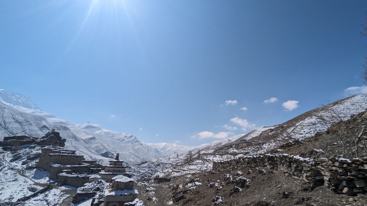
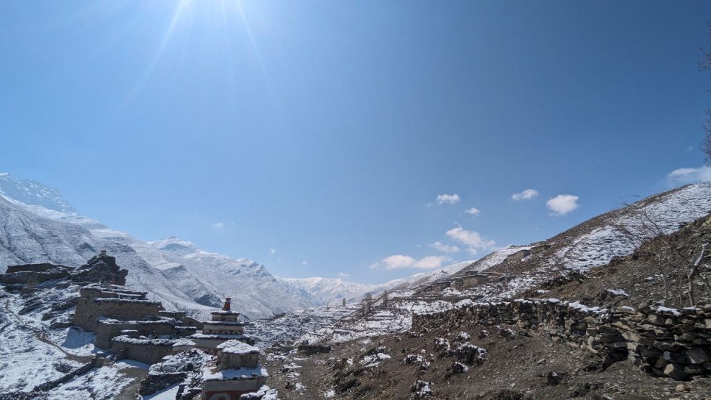
We continued to Lhawanbagar, where we enjoyed a simple breakfast of tea and biscuits. We took the opportunity to dry our wet shoes by the fire, still damp from our earlier river crossing. Refreshed, we resumed our trek towards Elakot. Crossing a long suspension bridge, we took the left turn towards Elakot. From afar, the village was visible, but what truly captivated me were the three villages perched atop separate hills. The uniformly styled houses, set against the barren hills, were a mesmerizing sight.
Excited by the view, I couldn’t resist taking out my drone to capture footage of these unique settlements. While I had seen various Himalayan villages before, these were distinct with their mud-colored houses, likely plastered with mud, which added a unique charm. I shared my excitement with Kailash dai, who was equally enthusiastic about exploring these villages, even if it meant deviating from our planned route.
Elakot and Deciding on Detour
Upon reaching Elakot, we enjoyed Tumba, a local fermented beverage, and had lunch. One of the intriguing villages, still drawing my attention, was right above us. Fortunately, the owner of the teahouse where we had lunch was from Gumbatara, one of the three villages. He explained that these villages—Gumbatara, Shahtara, and Tupatara—were sister villages, each dominated by a different caste: Magars in Gumbatara, Rai and Tamang in Shahtara, and Kami in Tupatara.
Intrigued by this information and realizing that we might not encounter such settlements again on our trail, we decided to take a detour to Gumbatara and spend the night there. After lunch, we set off for Gumbatara, a steep 1.5-hour uphill walk. Upon reaching the village, I was delighted to find it even more beautiful than expected.
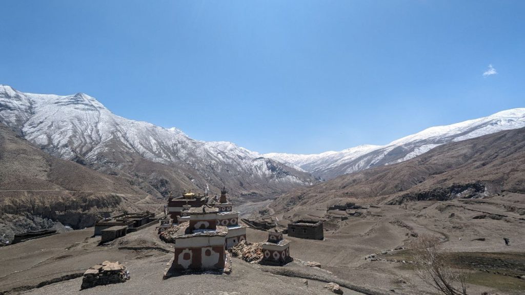
Experiencing Gumbatara
The settlement was mesmerizing with clustered houses of uniform architecture. The village had a huge field with two large trees in the middle, a Gumba (monastery), and a temple, both revered by the locals. I met a resident who often visited his ancestral home in Gumbatara, despite living in Kathmandu. He shared that the land, although appearing barren during spring, would be lush green after the monsoon with crops like barley, buckwheat, and maize. These crops would sustain the villagers throughout the year.
Most villagers lived in Nepalgunj, Kathmandu, or Pokhara and returned during the yarsagumba (caterpillar fungus) harvesting season, which was a few weeks away. This detour allowed us to gain a deeper understanding of local life and culture. I took numerous photographs and drone shots of the village and its surroundings, thrilled with our decision to explore this unique settlement.
Day 4 – Gumbatara to Lahini to Tilba
We woke up early, as was becoming our habit, and quickly hiked down the hillock of Gumbatara, rejoining our original trail. Our next destination, Lhasigap, was about three hours away. The path was a mix of curves and relatively flat stretches, with a slight climb towards the end. I set a brisk pace, while Kailash dai, a few paces behind, kept his steady rhythm.
Unexpected Challenges at Lhasigap
Upon reaching Lhasigap, we encountered an unexpected and challenging situation. Our porter suddenly announced that he could not continue and left us stranded. This was a significant setback, especially since I had my own trekking backpack to carry, and Kailash dai, with his back problems, couldn’t possibly take on the additional load. The porter was essential to our journey, and his departure left us in a difficult position.
We quickly assessed our options over breakfast at a local teahouse. We consulted with the locals and the teahouse owner, hoping to find someone who could step in as an emergency porter. Unfortunately, no immediate help was available. In a moment of foresight, I had saved the phone number of our kind host from Gumbatara. I called him, explained our situation, and asked if he could find someone to help us. Thankfully, he promised to do his best.
Rescue by Sher Bahadur Rokaya
After an anxious two-hour wait, our host called back with good news—he had found someone to help us. Another 1.5 hours later, Sher Bahadur Rokaya arrived. He was a middle-aged man, experienced in trekking and familiar with the high passes we were about to tackle. Sher Bahadur’s arrival was a relief, and his presence would prove invaluable as our journey continued.
To Lahini and Tilba
With Sher Bahadur now part of our team, we resumed our trek with renewed determination. We had lost a considerable amount of time, so we increased our pace. The trail from Lhasigap to Lahini was challenging, involving a steep uphill climb of 2-3 hours. It is essential to carry a water bottle, as the trek includes long stretches without water sources. The climb took us through verdant pine forests, with breathtaking views of the hills, the Dho River flowing through the gorge, and the distant white peaks of the mountains. Despite the difficulty, the walk was invigorating with the magnificent landscape.
We reached Lahini relatively quickly and inquired about the next stop. Tilba was another 1.5-2 hours away. Given the ample daylight left, we decided to push on and make our stop for the night at Tilba. The additional uphill climb was demanding, but we managed to reach Tilba after two hours. Tilba had only one teahouse, run by a lady with no helping hands. We were the only guests for the day.
After such a physically and mentally exhausting day, we freshened up and enjoyed some local wine to relax. We also helped out in the kitchen, preparing a beef jerky curry to be served with rice. The meal was hearty and delicious, providing much-needed nourishment after a tough day. The comforting meal and the satisfaction of overcoming the day’s challenges ensured a good night’s sleep.
Day 5 – Tilba – Dho Tarap, Heart of Upper Dolpo
I woke up with a funny feeling in my heels, a bit of pain that sparked some nervous apprehension. Would it grow worse as the day went on? I kept this to myself, though in hindsight, I should have shared it with Kailash dai and Sher Bahadur. Today promised to be our longest walk yet, over 25 kilometers, so we started early, around 6 AM.
From Chhygor to Nawarpani
The morning was beautiful with a mild temperature, perfect for trekking. The trail, running alongside a gorge, was a mix of straight paths and slight uphill climbs. After an hour of walking, we reached Chhygor, an isolated dwelling. Continuing on, we arrived at Nawarpani at 3720 meters after about two hours. Here, we decided to have breakfast—a simple meal of tea and biscuits served in a tent run by an old lady. Other tents were being set up in preparation for the upcoming Yarcha harvesting season.
Onward to Toltol and the Unexpected Help
Our next stop was Toltol, where we planned to have lunch since the next settlement, Dho Tarap, was 17 kilometers away. In previous years, there were teashops in Sisol, halfway between Toltol and Dho Tarap, but this year, none were operating.
By 11 AM, we reached Toltol, and my right heel was not improving. We rested and had the typical Dal Bhat for lunch. Knowing we had a long stretch ahead, we set off again without delay. The trail from Toltol to Dho Tarap is relatively easy in terms of terrain but incredibly long, testing our endurance. I reached Sisol in about two hours and waited for Kailash dai, who arrived an hour later, visibly exhausted. He admitted to feeling dizzy and that his legs were heavy, each step a struggle. This worried me greatly as we had no choice but to reach Dho Tarap.
Fortune smiled upon us when a motorcyclist heading to fetch his people from Sisol agreed to give Kailash dai a ride to Dho Tarap. After some haggling over the fare, we sent Kailash dai on the motorcycle, and Sher Bahadur and I continued on foot.
The Long Walk to Dho Tarap
We munched on some Snickers and hydrated ourselves before resuming our trek. The trail, a motorable road, seemed endless. Along the way, we were treated to the sight of over a hundred Blue Sheep crossing the river, a mesmerizing scene that brought tears to my eyes. I quickly captured photographs of the moment before we continued our journey.
We finally reached Dho Tarap around 5 PM after a grueling 28 kilometers. My right ankle was swollen, but the adrenaline rush had masked the pain. We checked into Buddha Guest House, a local hotel, and despite the day’s difficulties, reaching Dho felt like a significant achievement.
Day 6 – Rest, Acclimatization and Exploring Dho Tarap

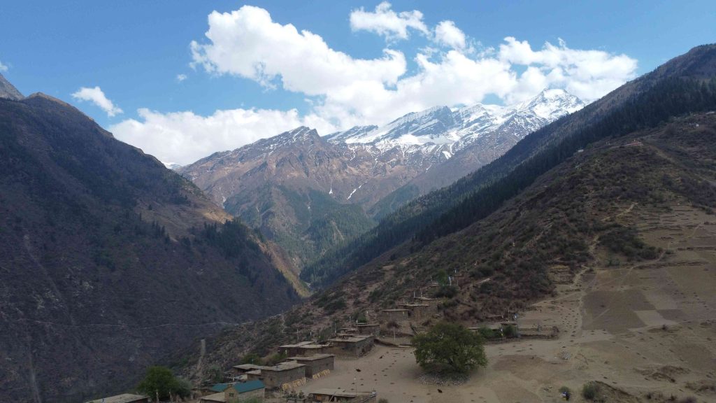
After the grueling trek of the previous day, we dedicated the fifth day to exploring and acclimatizing in Dho Tarap. Nestled at approximately 4,080 meters, Dho Tarap is one of the highest human settlements in the world. It is also the heart of Upper Dolpo region. This beautiful village, along with its neighboring settlements of Tokyu and Lang, forms a cultural and administrative hub in Dolpo.
As we stepped out of our accommodation, we were greeted by the serene beauty of the village. The traditional mud-brick houses, the distant snow-capped peaks, and the peaceful ambiance were mesmerizing. It felt like we had stepped into a different world, untouched by the hustle and bustle of modern life.
A Stroll Around the Dho Tarap
We started our day with a leisurely stroll around Dho. The village has around 120 households, each built in a unique architectural style with larger living spaces underground. This design is not only fascinating but also practical, providing insulation against the harsh weather conditions.
The streets of Dho are lined with ancient mani walls, prayer wheels, and stupas, reflecting the deep-rooted Buddhist and Bon traditions of the region. The villagers we met were warm and welcoming, always ready with a smile and a greeting.
Cultural Immersion and Local Life
Our stroll took us to the local monastery, a significant spiritual center for the villagers, of the Upper Dolpo life. The monastery, with its intricate woodwork and vibrant frescoes, is a testament to the rich cultural heritage of Dho Tarap. We spent some time here, soaking in the peaceful atmosphere and learning about the spiritual practices of the locals.
We also visited the local school, where children were busy with their lessons. Despite the remote location and limited resources, the enthusiasm and eagerness to learn were evident in the eyes of the students. It was heartwarming to see the community’s dedication to education and preserving their cultural heritage.
Meeting the Locals
One of the highlights of our day was interacting with the local people. We met Sherpa, Magar, and other ethnic groups who call this region home. Each group has its unique traditions, yet they all share a deep connection to the land and a simple way of life that revolves around agriculture and animal husbandry.
As the day came to an end, we returned to Dho, reflecting on the experiences of the day. The village, with its breathtaking landscape, rich cultural heritage, and warm-hearted people, had left a deep impression on us. We felt grateful for the opportunity to immerse ourselves in this unique way of life, even if only for a day.
Dho Tarap is more than just a stop on a trek; it is a place that invites you to slow down, reflect, and connect with the essence of life. The experiences and memories we gathered here would stay with us forever.
Day 7 – Dho to Jyanta La Pass to Rapagaon
We knew today would be tough, as we had to cross our first mountain pass, Jyanta La, at 5,124 meters. To make our day a bit easier, we opted to take motorcycles to the base of the pass. The morning was cold, but the ride was exhilarating as we passed through the Takshi village, a large settlement of Dolpo Tibetan people. The village was beautiful, with traditional houses nestled in the valley.
The motorable road then diverged from the village, splitting into two paths: one towards Choyu La Pass and the other towards Jyanta La. We took the latter. After a half-hour ride, we reached the base of Jyanta La. From this point on, the journey had to be completed on foot as the bikes could go no further.
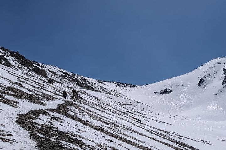
Reaching Jyanta La Pass 5124 meters
We hopped off and began our ascent. The trail was a gradual climb, surrounded by snow-capped mountains on three sides. The landscape was stunning, but the wind grew stronger and colder as we climbed higher. We bundled up in warm layers, with hats covering our ears, and pressed on.
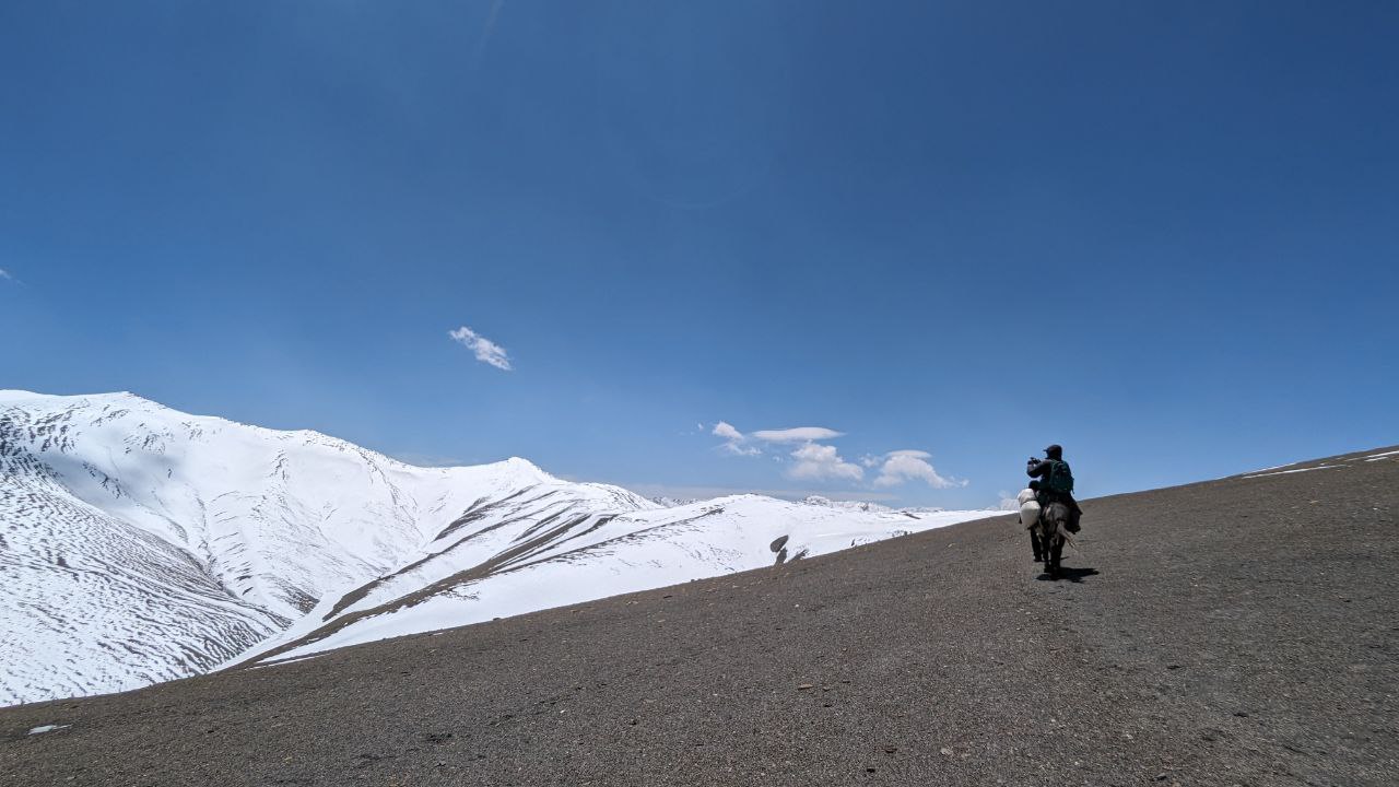
After about two hours of walking, covering approximately six kilometers, we reached the pass. We were not alone; a few mule herders and traders with horses were also making their way across. The sense of accomplishment was palpable, but our joy was short-lived.
Kailash dai, my trekking partner, wasn’t feeling well. He was experiencing extreme dizziness and nausea, symptoms of Acute Mountain Sickness (AMS). Given the remote location and the distance to the next village, it was a cause for concern. Instinctively, we decided not to take any risks. We negotiated with one of the traders to give Kailash dai a lift on horseback to the next village, about 19 kilometers away. Sher Bahadur and I, feeling fit, decided to continue on foot.
The Descent and Snowfall
The descent was steep and treacherous. The trail was muddy and slippery from melted ice, making every step a challenge. After about an hour of fast-paced walking, we reached the riverbank of Nagon Khola. The rest of the journey involved following the river, crossing it a few times. At one point, we lost our way in thick, thorny bushes. After checking my map and retracing our steps, we found the correct trail.
Around 3 PM, it started snowing heavily. We had to pick up the pace to avoid getting caught in worsening conditions. We almost trotted, covering over 7-8 kilometers per hour. Finally, we reached Chagaon, where the snow had stopped. Kailash dai had arrived a couple of hours earlier, taken medicine, and rested.
We regrouped and checked on Kailash dai. He felt better and agreed to push on to Rapagaon, about 1.5 hours away. It was almost dark when we arrived at Rapagaon, another beautiful settlement. Just as we found accommodation, it started snowing heavily. We warmed ourselves by the fire, had dinner, and settled in for the night.
The next morning, we woke up to find Rapagaon transformed into a winter wonderland. The village was covered in a blanket of snow, turning it into a white paradise. The sight was breathtaking, making us forget the challenges of the previous day.
Day 8 – Namdo to Saldang
We didn’t bother waking up as early as usual since today’s journey was fairly short. As we stepped out, the village was blanketed in the previous night’s snowfall, transforming it into a winter wonderland. The cluster of villages collectively known as Namdo, including Rapagaon, Chagaon, and Sugugaon, presented a serene and picturesque scene.
Leaving Rapagaon, we began our trek towards Saldang, a significant cultural hub and one of the most ancient settlements in the Dolpo region, only 7 kilometers away. The morning was beautiful with clear skies, and the weather had turned for the better. The walk was easy, passing through the sister villages of Namdo.
Arriving in Saldang, we found accommodation and took the opportunity to rest. The exhaustion from the previous day’s strenuous trek had not fully worn off. Saldang, being a major hub of this trek, allowed us all day to rest and explore. Additionally, the following day was set aside for acclimatization, so we wouldn’t be walking, giving us ample time to rejuvenate and appreciate this significant village.
Day 9 – Rest Day at Saldang
We had the luxury of a rest day in Saldang, which allowed us to explore and immerse ourselves in the local culture. Saldang at 4091 meters altitude is the cultural center and trading hub of Upper Dolpo. At the intersection of Upper Dolpo region, Saldang has a rich history dating back centuries. It is one of the most ancient settlements in Upper Dolpo, and its strategic location has made it a center for trade and cultural exchange.
We spent the day visiting the local school and the police station, where we had enlightening conversations with the teachers and officers. They shared insights into the daily lives of the villagers, the challenges they face, and the efforts being made to improve the region’s connectivity and infrastructure. We learned that a motorable road was under construction, which would connect Upper Mustang with Saldang, making it more accessible and fostering greater interaction with the outside world.
One of the most interesting pieces of information we gathered was about Ku, one of the youngest villages in terms of recognition by the Nepal government. This village, though recently recognized, plays a significant role in the cultural tapestry of the region. The locals proudly spoke about their lifestyle, which revolves around trading salt and goods with Tibet, grazing yaks, and leading a semi-nomadic life. This unique way of living has been preserved through generations, making Saldang and its surrounding villages a living museum of ancient traditions and practices.
Preparation for Tomorrow
Given our recent scare with Kailash dai’s health and the demanding nature of the upcoming trek, we decided to take precautions for the next leg of our journey. We had two more mountain passes to cross in the following days, and the recent snowfall had made us apprehensive about the conditions we would face. After much discussion, we decided to rent a horse and hire a local guide to accompany us. This decision was driven by the need for extra support and the assurance that we could navigate the snow-covered passes safely.
The rest of the day was spent resting and mentally preparing for the days ahead. We visited various parts of the village, observing the traditional lifestyle of the Upper Dolpo people. Their homes are designed to withstand the harsh weather conditions. The villagers are warm and hospitable, embodying a simple yet resilient way of life that is deeply connected to their land and traditions.
Day 10 – Saldang to Shey Gompa via Shey La Pass (5112 m)
The trek to Shey Gompa was one of the best days we had so far. We started early, now with four of us, along with a horse. Kailash dai would alternate between riding uphill and walking on foot when he could. Unlike previous days, he did not show any symptoms of AMS and was, in fact, walking just fine. I took the opportunity to ride the horse when Kailash dai opted to walk.
The walk was pleasant, with only the stretch to reach the Shey La Pass being a bit steep. Apart from that, it was fairly easy. There were ascents to make, but they were gradual rather than difficult. Along the way, we spotted some wildlife, including another bunch of blue sheep (Nhawar) and a small creature that looked like a meerkat, though we couldn’t identify it. Before we knew it, we reached the Shey La top at 5115 meters. Despite having a horse, Kailash dai walked on foot most of the time.
Shey La Pass (5112 meters)
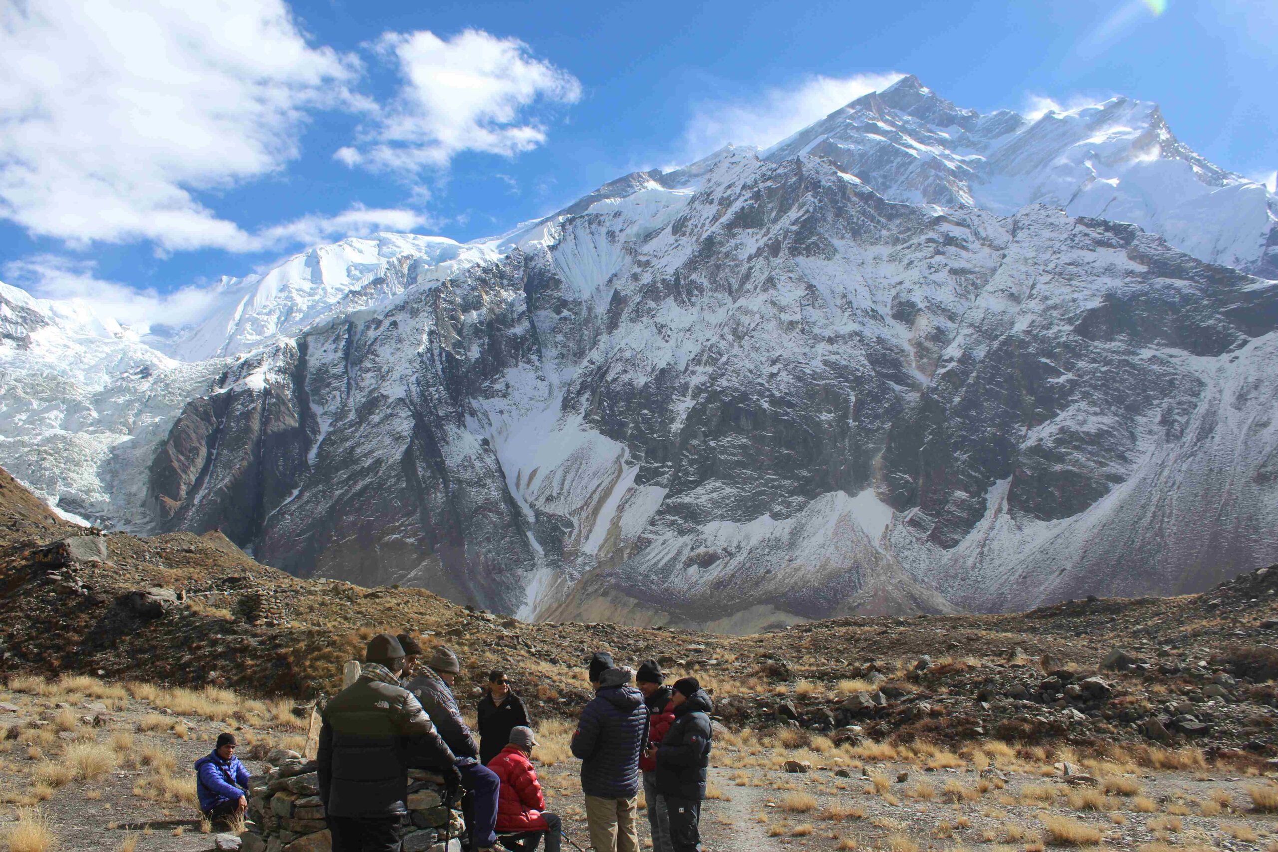
Reaching the top was a mesmerizing experience. The Himalayas stretched as far as we could see, with a clear blue sky above and snow-capped mountains kissing the horizon. Another layer of barren mountains added to the stunning view. We took pictures at the top, and to my amusement, Kailash dai started rejoicing and dancing. It was a beautiful and joyous moment for us.
We then descended, and the first half hour was slightly tricky due to snow on the path. Nonetheless, we made it without any difficulties. After the descent, it was another two hours before we reached Shey Gompa. We decided to munch on some protein bars and dry fruits before continuing.
Shey Gompa, a Haven of Upper Dolpo
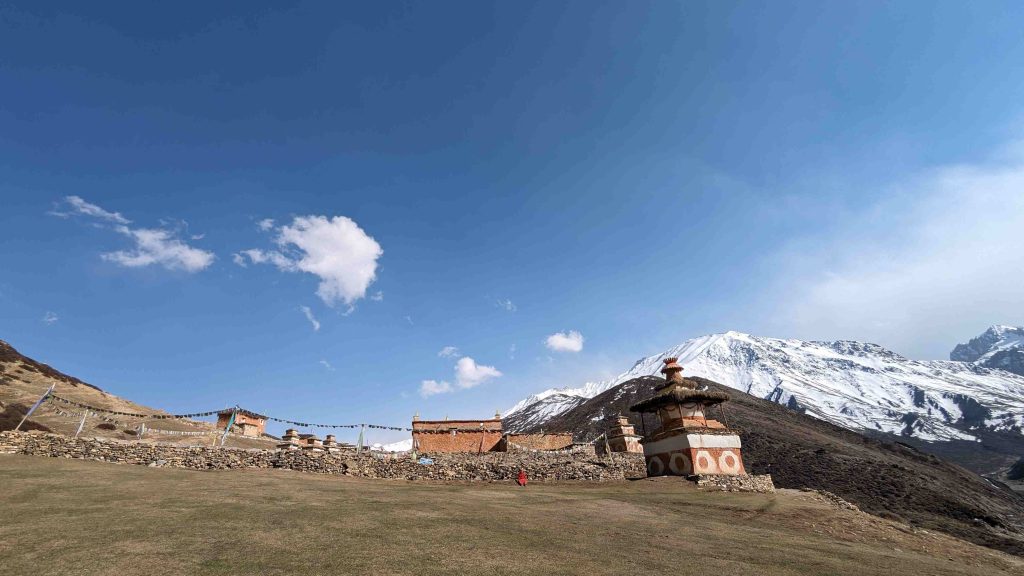
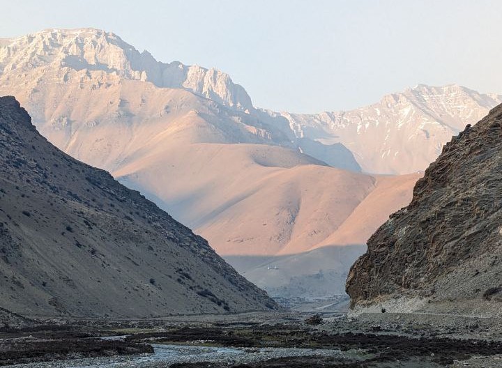
The path to Shey was straightforward with small descents. We reached Shey with four more hours of daylight remaining. Shey is another breathtaking landscape. It holds the largest monastery in the Dolpo region and is the most sacred place for the Dolpo people. The hamlet is placed on a beautiful plain grassland surrounded by mountains on all sides, with a river cutting right through the valley. For me, personally, it was one of the most beautiful scenes I had beheld on this journey.
We took refuge in a tea house right beside the Shey Monastery, which was the only one operating at the time. I roamed around the village and took a nap on the green grassland where yaks were grazing. I was truly in awe of the place.
In the evening, we found that the host was not very amicable towards us, which was a fairly odd experience. Nevertheless, we were served our food and shown our place to sleep in the lobby. We had to curl in, and it was not very comfortable, to be honest. This experience made us realize that the Upper Dolpo trek is best done with camping gear of your own. Resting in tea houses and also camping wherever feasible would have been more ideal.
The next day was going to be a difficult one, as we had to cross the highest and most treacherous pass, which was covered in heavy snow from the last couple of days, making the walk more challenging.
Day 11 – Crossing Kang La Pass and Night in the Forest
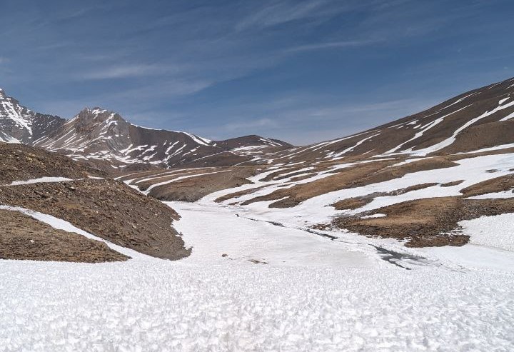
We started super early the next day. It is advisable to begin your trek before dawn while crossing mountain passes, and we did the same. In about 1.5 hours, we reached the base of the Kang La Pass. Upon reaching it, we found that the actual trail would be almost impossible to cross due to heavy snow. There was an alternative route, a longer one, which the mule herder and our guide with the horse were going to take. They advised us to take the normal route while they took the alternative one.
All three of us—Kailash dai, Sher Bahadur, and I—looked ahead, contemplating the snow-covered, steep trail. Despite their advice, we chose to follow the alternative route. We were quite surprised and angry as to why they advised us to take the difficult route.
Battling Blizzard
Ascending Kang La Pass (5346m) was grueling. From the outset, biting winds swept across the terrain, intensifying with altitude gain. Each step through the snow felt endless. It was very difficult for me, and I could sense that it was the same for my partners too. Nevertheless, we kept trudging up, constantly being hit by the blizzard, and barely made it to the top. As conditions worsened, we regretted our choice, struggling against the blizzard’s fury. Despite the challenges, we persevered, driven by the need to reach the summit.
Upon reaching the summit, relief mingled with disbelief. Kang La’s crest offered a breathtaking vista of snow-capped. However, our elation was short-lived as the blizzard intensified, assaulting us mercilessly. With visibility reduced to a blur, we hunkered down, seeking refuge from the storm’s fury. The small snowflakes hit my face at lightning speed, feeling like glass shards against my skin. The wind was extremely strong. Our horse and the guide were nowhere in sight; they must have crossed it ages ago. We three went to our knees, curling into balls, trying our best to avoid the brunt of the storm, but to no avail.
In that moment of desperation, it hit us all that we had to move forward, no matter how difficult it was. Staying there was not an option, as there were no signs of the blizzard stopping. With much difficulty, we rose and started walking very slowly, pushing through the harsh conditions. After a grueling effort, we finally crossed the blizzard. The weather on the other side of the mountain was clear with no wind, a stark contrast to the storm we had just endured. We descended and reached the bottom, finally able to rest and gather our thoughts.
Descent from Kang La and Night in the Forest
Descending from Kang La was no less arduous. The treacherous downhill path demanded caution amid slippery rocks and weary legs. Hours passed before we finally reached the base, where the tranquil waters of Phoksundo River awaited us. The sight of the river, flowing calmly amidst rugged terrain, brought a sense of accomplishment and relief.
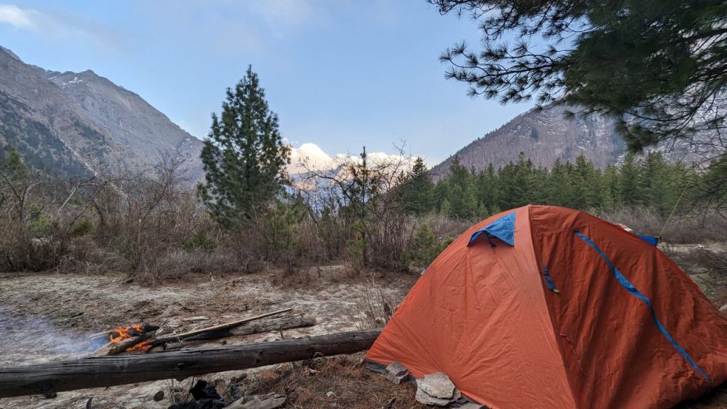
With Ringmo still distant, we settled for a night in the forest near Thulodunga. rom Saldang, we had rented a camping gear, which now proved invaluable. Armed with rented camping gear, we found shelter among timber cutters. Gathering around a campfire, we shared a humble meal of khichdi, grateful for their hospitality amidst the wilderness. The night, though challenging with howling winds and makeshift bedding, offered a chance to reflect on the day’s trials and triumphs.
Day 12 – Phoksundo Lake and Ringmo
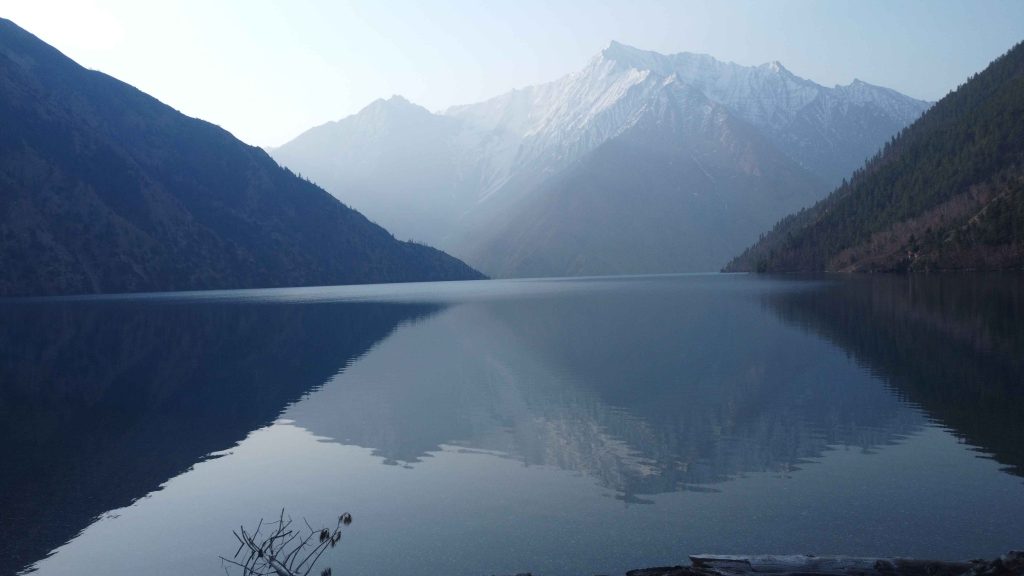
The morning unveiled the breathtaking beauty of Kanjiroba Himal towering above us, framed by a pristine pine forest and the melodious Phoksundo River. Today held a special promise as we aimed for Phoksundo Lake, the apex of our journey. A serene hour-long trek through the pine forest brought us to the lake’s shore.
Phoksundo Lake greeted us with its unparalleled beauty—crystal-clear waters mirroring the surrounding mountains. Unlike my previous visit from the other side, this view from Ringmo’s end was wild and untouched, devoid of human settlements. The Y-shaped lake concealed one end from the other, a hidden gem often missed by those on the Shey Phoksundo Trek. I strongly recommend taking an extra day to circumnavigate the lake; its beauty is truly worth the detour.
Trek to Ringmo Village
Leaving the lake behind, we embarked on a challenging ascent and descent, the lake always beside us on the left. The trail, though steep at times, was made easier by the mesmerizing view of Phoksundo Lake accompanying us throughout. After three hours of trekking, we arrived at Ringmo village around noon, greeted by a sense of tranquility and awe.
Having breakfast amidst the serene ambiance of Ringmo, we spent the remainder of the day immersed in the lake’s beauty. We strolled along its banks, dipped our hands into its cold waters, and simply sat in contemplative peace. Ringmo, our penultimate destination, marked the culmination of our journey through Upper Dolpo.
Upper Dolpo Reflections
For the first time in weeks, we enjoyed the luxury of WiFi connectivity, sharing our journey’s visual tapestry with friends and loved ones. As evening descended, we savored a hearty meal prepared by our gracious hosts, concluding a day filled with natural wonders and warm hospitality.
As our expedition through Upper Dolpo drew to a close, Ringmo and Phoksundo Lake stood as poignant reminders of the region’s untamed beauty and spiritual depth. Our hearts were full, our memories rich with the sights and sounds of this remote Himalayan realm. Tomorrow, our final trek to Juphal would complete this transformative journey, leaving us forever changed by the majesty of Dolpo.
Day 13 and 14 – Phoksundo to Chhekpa to Dunai
With heavy hearts, we started our day later than usual after a leisurely breakfast, bidding farewell to the pristine beauty of Phoksundo Lake. Our journey back to Dunai would span two days, following a trail that meandered alongside the ever-present Phoksundo River.
Trek to Chhekpa
The trail from Phoksundo to Chhekpa offered a relatively easy trek, interspersed with occasional steep descents. The comforting presence of Phoksundo River accompanied us throughout, its soothing sounds guiding our steps. By day’s end, we reached Chhekpa, where we settled in for the night.
Final Leg to Dunai
On our final day of trekking, we embarked from Chhekpa towards Dunai. The trail, familiar now from our earlier days, unfolded with a sense of nostalgia and accomplishment. Each step brought us closer to the end of our expedition through Upper Dolpo.
Epilogue
With memories etched deep within us and a sense of fulfillment, we bid farewell to Upper Dolpo. The trek had tested our limits, expanded our horizons, and enriched our souls. As we departed Dunai, our hearts brimmed with gratitude for the privilege of experiencing the magic of Dolpo—a place where time seemed to stand still amidst the grandeur of the Himalayas.